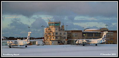
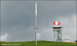
The New Millennium
Ronaldsway Air Traffic
entered the new millennium working in a wartime building over 50 years
old, but with modern equipment - a Plessey Watchman PSR with Cossor
SSR radar, Frequentis communications and Stonefield Flight Processing system.
Plans were already afoot that by the end of the decade would end up with
major changes to the airfield layout, but started with a section of new
taxiway, that mainly duplicated the existing Northern taxiway. Most
airline routes were covered by Manx Airlines and Jersey European with Aer
Arann operating from Dublin and Comed Aviation from Blackpool, Emerald
Airways covered air freight and mail operations.
Ronaldsway airlines
at the start of the 2000s
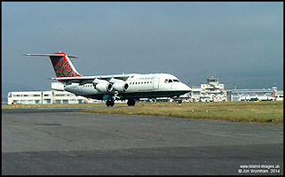 Manx Airlines 146-200
G-MIMA arriving from Heathrow, July 2000
Manx Airlines 146-200
G-MIMA arriving from Heathrow, July 2000
|
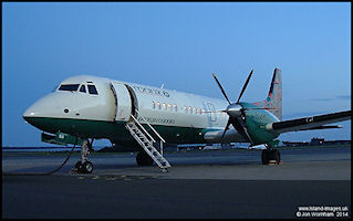 Manx Airlines ATP
G-MANA in August 2000
Manx Airlines ATP
G-MANA in August 2000
|
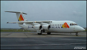 Jersey European BAe
146-200 G-JEAK in February 2000
Jersey European BAe
146-200 G-JEAK in February 2000
|
 Manx Airlines Jetstream
41 G-MAJA in August 2000
Manx Airlines Jetstream
41 G-MAJA in August 2000
|
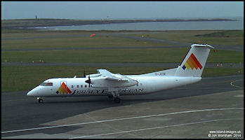 Jersey European Dash8-Q300
G-JEDE in February 2000
Jersey European Dash8-Q300
G-JEDE in February 2000
|
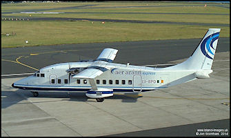 Aer Arann Short 360
EI-BPD in August 2000
Aer Arann Short 360
EI-BPD in August 2000
|
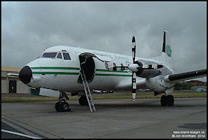 Emerald Airways Avro
748 G-BVOV in August 2000
Emerald Airways Avro
748 G-BVOV in August 2000
|
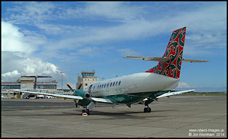
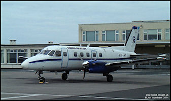 Comed Aviation Bandeirante
PH-FVA in June 2000
Comed Aviation Bandeirante
PH-FVA in June 2000
|
Manx Airlines/British
Regional Maintenance
British Regional Airlines,
Manx Airlines parent company, had a major engineering base on the airfield,
servicing their fleet of BAe 146, ATP, Jetstream 41 and ERJ145 Aircraft.
At the start of the decade, deliveries of new Embraer 145s to British Regional
were just over half way through the total order of 23, all aircraft being
delivered initially to Ronaldsway from Brazil before entering service at
UK bases. Most aircraft in the fleet visited on a regular basis.
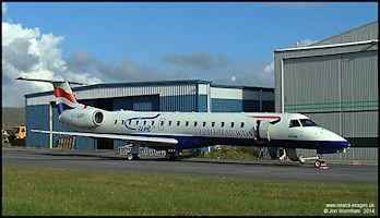 BRAL Embraer 145
G-EMBP - on delivery in August 2000
BRAL Embraer 145
G-EMBP - on delivery in August 2000
|
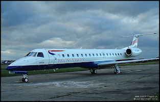 Embraer ERJ145 G-EMBS
- on delivery in December 2000
Embraer ERJ145 G-EMBS
- on delivery in December 2000
|
Airline changes
2000 - 2014
The Isle of Man Government
has an 'Open Skies' policy, i.e. any airline that wants to start or stop
services to or from the Isle of Man is free to do so without government
interference. From a fairly stable airline situation through the
1990s to the start of the 2000s, this has resulted in numerous changes
to the operators at Ronaldsway.
To avoid overcrowding
this ATC History page, I have created a separate section to try and follow
the changing airline scene up to 2014.
Isle
of Man Airline Operators in the 2000s
Ronaldsway Airfield
Alterations
The first stage of a
major airport construction project started when a new taxiway was built
linking the old 'Central' taxiway with the 'Northern' taxiway, crossing
runways 17/35 and 21/03. All of the taxiways were re-designated at this
time, the new taxiway becoming 'Taxiway Alpha'. From an ATC point of view
the new section didn't offer many advantages over the old layout and the
'Northern Taxiway' remained very much in use until a management decision
to obstruct the section east of runway 21 so only vehicles could use it.
This hasn't stopped aircraft taking it by mistake and even in recent years
more than one aircraft has had to be pushed back out of the resulting cul-de-sac
by a tug!
This was, however, just
the initial stage of a much larger project which would see the runways
lengthened and the taxiways reaching the end of the runways, enabling departing
aircraft to line up directly, rather than the time wasting 'backtrack'
that had been required before. On the taxiways, red 'Stop Bars' were introduced
at holding points to protect the runways during night and low visibility
operations. Previously the green taxiway centreline lights ran past the
holding points and onto the runways, but with the new system, when the
Stop Bars were selected on a line of red lights would appear across the
taxiway at the holding point and the green centreline lights beyond were
suppressed. The Stop Bars defaulted to 'on' and were switched from a revised
lighting control panel in ATC.
|
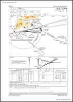
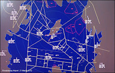
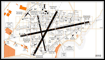
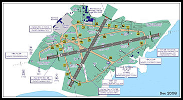
Ronaldsway Airport
Diagram 2002
Initial stage of 'Taxiway
Alpha' has been constructed
linking 'Taxiway Charlie'
and into the old 'Northern' taxiway, the remaining section becoming 'Echo'
|
New Instrument
Landing System installed for Runway 08
Over the years there
had been discussion as to whether it was feasible to install an ILS to
serve runway 08. The main problem was that there was no space at the end
of the runway to install the Localizer aerial in the usual location. Following
a report on two serious
incidents and one accident
occurring to aircraft making approaches to runway 08 using the 'IOM' VOR/DME
procedure it was decided that an ILS could be provided for the runway but
using an 'Offset Localizer'. This was common practice at military airfields
where there was usually a 'stop end crash barrier' at the end of the runway,
but more unusual at civil airports. The Localizer was situated to the south
of runway 26/08 with its beam angled across the runway by 3 degrees, the
Glideslope aerial being conveniently located on the right hand side of
the runway abeam the touchdown point. In association with the project,
the 'RWY' Non Directional beacon (NDB) was moved from its previous location
at the eastern boundary of the airfield to a more central location on the
south side of the airfield adjacent to taxiway Charlie. The Distance Measuring
Equipment (DME) that had served the runway 26 ILS was moved a short distance
from the VHF Direction Finding site to be adjacent to the 'RWY' NDB. The
reason for this was that it was then equidistant from the two ILS systems
and could serve either, the morse identification being changed to reflect
the actual ILS in use, I-RY for runway 26 and I-RH for runway 08.
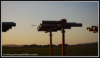 Ronaldsway Runway
08 Offset Localizer
Ronaldsway Runway
08 Offset Localizer
|
|
Runway 08 Offset
ILS/DME Approach
Approach Procedure plan
view showing the offset Final Approach Track of 087 degrees
|
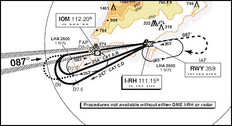
|
Click
for full Chart
|
Runway 08 Offset
ILS/DME Approach
Vertical profile of
the Approach Procedure. Normal practice was for Radar to vector aircraft
onto a closing heading for the Localizer.
|
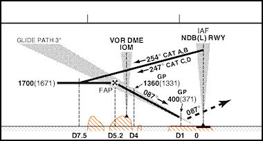
|
The Offset ILS Approach
Runway 08
Using Microsoft
Flight Simulator X and Real Air Beech Duke to demonstrate the offset ILS
approach
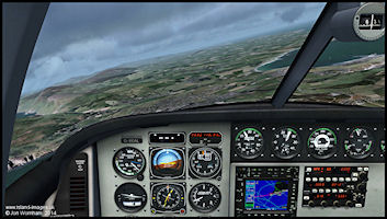 Establishing on Localizer
and Glideslope at 6 miles from touchdown
Establishing on Localizer
and Glideslope at 6 miles from touchdown
|
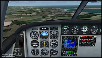 Showing Localizer
offset from the runway at 2.7 miles from touchdown
Showing Localizer
offset from the runway at 2.7 miles from touchdown
|
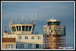
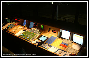
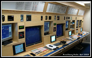
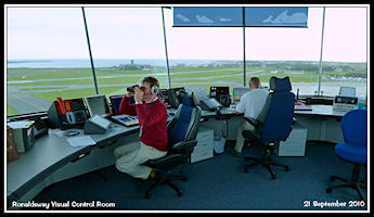
The Visual Control
Room Rebuilt in 2001
The metal tower desk
built in 1995 had proved difficult to adapt to new equipment requirements
and so was replaced in 2001 with a new one of wooden construction. Unlike
in 1995 it was decided that ATC needed to move out whilst the work was
undertaken and so a temporary Visual Control position was built on the
second floor of the control tower, in an annexe to the main telecommunications
equipment room. Although the main airfield could be seen adequately, to
view the parking aprons needed installation of CCTV monitors using
the airfield security camera system.
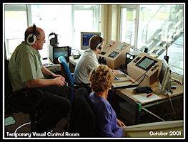 Temporary Visual
Control Room 2001
Temporary Visual
Control Room 2001
|
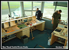 New Visual Control
Room desk under construction
New Visual Control
Room desk under construction
|
|
The new Visual Control
Room desk
A night photo of the
new wooden desk
|
Visual Control Room
Equipment
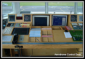 Controller Workstation
|
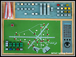 Airfield Lighting
Control Panel
Airfield Lighting
Control Panel
|
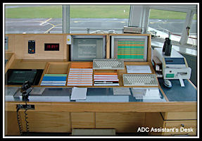 Tower Assistant Workstation
|
Also installed at this
time was 'ATIS' - Automatic Terminal Information Service. This transmitted
airfield information on a discrete frequency of 123.875 Mhz including the
latest weather report, runway in use and any other pertinent airfield information,
e.g. navigation aid unservicabilities. With a stream of inbound aircraft,
the ATIS saved considerable radio time in reading out the weather to each
aircraft as it came on frequency. The broadcast was prepared by the ATC
Assistant on a computer terminal and was compiled by the program using
a 'text to speech' technique before being broadcast.
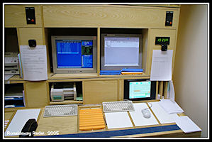
The Briefing Office
in the terminal building had become an unmanned unit with all ATC staff
now working in the control tower. Pilots could fax flight plans to ATC
from there and they were then entered into the computer system which disseminated
them to other ATC units via the Aeronautical Fixed Telecommunication Network
(AFTN) and printed the Flight Progress strips in Tower and Approach
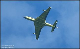
British Military
Aircraft at Ronaldsway
Ronaldsway has always
been visited on a regular basis by UK military aircraft, usually on training
flights, but as the picture of the RAF Hawk illustrates (click for details)
sometimes diverting
in with minor or major emergencies. Ronaldsway is often nominated as diversion
airfield for the Hawk aircraft from RAF Valley.
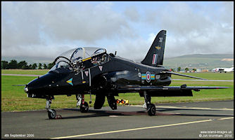 RAF 208 Sqn Hawk
after diverting into Ronaldsway
RAF 208 Sqn Hawk
after diverting into Ronaldsway
|
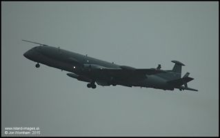
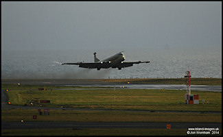 RAF Kinloss Wing
Nimrod MR2
RAF Kinloss Wing
Nimrod MR2
|
 Army Air Corps BN2T
Turbine Islander
Army Air Corps BN2T
Turbine Islander
|
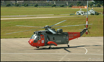 Royal Navy Sea King
'Navy 707'
Royal Navy Sea King
'Navy 707'
|
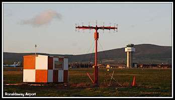
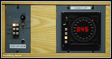
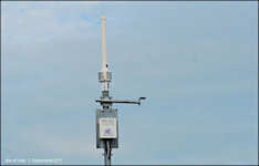
The VHF Direction
Finder
The very first navigation
aid installed at Ronaldsway in the 1930s was a Medium Frequency Radio Direction
Finder. This and the VHF Direction Finders that followed from the late
1940s were extensively used both for providing approaches to aircraft and
for ATC to obtain information on aircraft locations and assist in identifying
aircraft on radar. By the 2000s VDF Approaches had long since ceased and
with the coming of SSR radar to Ronaldsway in 1998 the D/F tended to be
less of an essential tool and was out of service for long periods of time.
However, if the radar
was not available for any reason and Approach was operating procedurally,
the D/F came into its own and with every aircraft transmission giving a
bearing, it was much easier to keep track of aircraft locations 'in the
pattern' and for ascertaining the initial direction of approach for inbound
aircraft. GPS had not yet come into general use and with a long over water
stretch, light aircraft with relatively poor radio navigation aids (or
indeed, no radio navigation aids!) could sometimes approach the island
from surprising directions. Indeed, I remember being told stories of light
aircraft pilots actually missing the island completely in poor weather
and having to be given QDMs (D/F based magnetic bearing) to the airfield.
Even with radar it was sometimes preferable to give a light aircraft QDMs
rather than a radar heading which could take them into cloud.
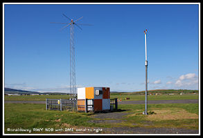
 VHF Radio Direction
Finding Aerial
VHF Radio Direction
Finding Aerial
|
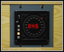 VHF Radio Direction
Finding Display
VHF Radio Direction
Finding Display
|
Non Directional
Beacons
Another navigation aid
originating in the 1930s, NDBs still provided an important service in the
2000s. The ground beacon operated in the Medium Frequency range and radiated
a uniform signal in all directions, hence 'Non Directional'. The aircraft
equipment required was the Automatic Direction Finder (ADF) which in its
simplest form shows the relative bearing of the beacon from the aircraft.
There were two NDBs associated with Ronaldsway, the 'RWY' located on the
airport and the 'CAR' at Carnane just to the south of Douglas. The beacons
identified themselves by transmitting the three letter designator in morse
code and pilots, after tuning in the beacon, had to listen to the morse
'ident' to confirm the correct beacon was being received before using it
for navigation. Most of the procedural instrument approaches to Ronaldsway
were based on the 'RWY' NDB, either using the beacon for the complete approach
or as a starting point for an Instrument Landing System approach.
|
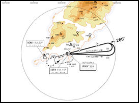
Instrument Approach
Chart
NDB/DME Approach
Runway 26
Chart from 2002, click
for full size
|
The 'CAR' beacon was
originally an en-route aid associated with the Advisory Routes (ADRs) approaching
the island from the east. When these were re-aligned to the 'IOM' VOR/DME,
Ronaldsway took on the beacon as a local aid, being particularly handy
in non-radar situations as it enabled some very useful procedural separations
between departing and arriving aircraft. The holding patterns at 'CAR and
'IOM' were procedurally separated enabling an aircraft to be climbed or
descended through the level of another in the other hold if required. Carnane
was also a very useful location to hold training aircraft 'out of the way'
to avoid delaying scheduled movements.
 Ronaldsway NDB
'RWY' on 359 KHz
Ronaldsway NDB
'RWY' on 359 KHz
|
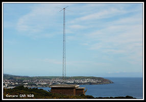 Carnane NDB
'CAR' on 366.5 KHz
Carnane NDB
'CAR' on 366.5 KHz
|
Approach Plate for
Runway 26 ILS showing the use of the two NDBs for initial positioning
|
Basic ADF aircraft
instrument
(on left side of picture)
The needle 'points to'
the NDB. Compass rose can be fixed with north at the top, giving a relative
bearing to the beacon, or as in this case be manually rotated to align
with the aircraft heading to give the actual bearing of the beacon from
the aircraft.
|
|
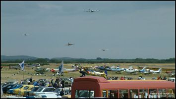
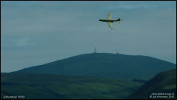
ATC at Jurby 2002 - 2004
The 1996 format for
airshows at Jurby was repeated in 2002, 2003 & 2004. Comprising a three
day event with air racing aircraft arriving on the Friday in a race to
the Isle of Man from the UK, with closed circuit racing on the Saturday
and Sunday mornings followed by an airshow in the afternoon. For the 2002
event, controllers from Ronaldsway provided an Air/Ground radio service
for the air races on all three days, but for the 2003 and 2004 events the
organizers provided the A/G race radio with controllers from Ronaldsway
providing a Tower ATC service outside race times on Saturday and Sunday.
A special Manual of Air Traffic Services was produced for Jurby and controllers
had Aerodrome Control Validations in their licenses. For continuity and
training purposes the same controllers generally worked the air shows on
all three years. In 2004 we started giving some prospective future
Jurby controllers 'work experience' there but there were to be no further
airshows.
 Jurby Radio - Operator's
Certificate
Jurby Radio - Operator's
Certificate
|
 Jurby Tower ATC Competence
2002
Jurby Tower ATC Competence
2002
|
 Jurby Tower ATC Competence
2003 - 2004
Jurby Tower ATC Competence
2003 - 2004
|
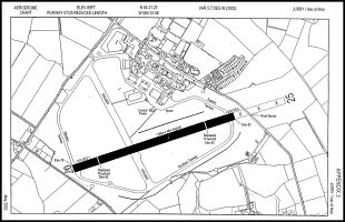
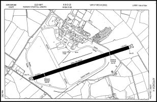
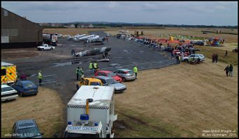
As for the previous
displays, the airfield could be operated in one of two modes - with the
Sandygate Road open to traffic the main runway 25/07 was shortened with
a physical length of 1,164m, but for the airshow the road was closed and
the full length of 1,463m became available, allowing larger and jet aircraft
to operate from the runway. The shorter cross runway was closed and used
for parking aircraft.
 Ops with the Sandygate
Road Open
Ops with the Sandygate
Road Open
|
 Jurby Ops with the
Sandygate Road Closed
Jurby Ops with the
Sandygate Road Closed
|
Air Traffic Control
facilities were basic to say the least, with a table provided in the control
room of the WW2 RAF control tower. A VHF radio base station operated through
a roof mounted aerial using temporary frequency 121.175 MHz, with radio
communications to vehicles operating on the airfield being via hand held
UHF radios. Other essentials for an ATC service were a telephone, clock,
logbooks and a Flight Progress Board. Latterly a fax machine was provided,
initially on the ground floor but for 2004 re-located to the end of the
ATC desk where it was of much more use. Other desks were provided for a
Met Observer and the Flying Display Director, the latter having operational
control over the flying display and ultimate control over who could fly
and who could not.
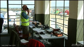 Jurby ATC - July
2003
Jurby ATC - July
2003
|
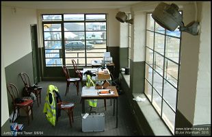 Jurby Control Room
- August 2004
Jurby Control Room
- August 2004
|
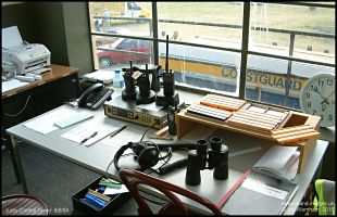 Jurby ATC Desk -
August 2004
Jurby ATC Desk -
August 2004
|
ATC at Jurby ran to
a fairly predictable pattern with the airfield and ATC opening in the morning
to allow visiting aircraft and participants to arrive and park. Aircraft
would ideally call about 10 minutes before arriving and be informed of
the surface wind, runway in use, circuit direction and airfield QFE (altimeter
pressure setting). In theory they should have used a standard overhead
joining procedure, but in general were allowed to carry out a direct join
to an appropriate visual circuit position. Often after landing they needed
to backtrack the runway to parking which could catch following pilots out
if they positioned too closely behind. Airfield circuits were always
carried out to the south as this was the only direction visible to ATC
from the tower.
When the air races were
in progress, ATC procedures were suspended and in latter years the ATCOs
could take a breather and listen to the race organizers operating an Air/Ground
radio service using the same frequency. As we were still providing
alerting for the emergency services it was important to keep this listening
watch although I think the only emergency that I can remember during the
races was when a Cessna 337 broke off the race and came into land with
the rear engine overheating. The Air races operated in accordance
with a handicapping system, with the slowest aircraft starting first and
the fastest last, the aim being to have a massed finish, so it will be
seen why there could be no air traffic control during the races, pilots
maintaining their own separation and (hopefully!) abiding by the Rules
of the Air. They were permitted to dive towards the finishing line which
provided a great show for the spectators.
The Air Show operated
under a normal ATC service with all participants having their display slot
allocated and being fully briefed on display lines (how close they were
allowed to come to the spectators) and procedures to be adopted in an emergency.
ATC was generally fairly easy during the display so long as there were
no emergencies, always a possibility, and pilots kept to their slots. The
RAF Red Arrows were always absolutely spot on with times, some other participants
less so! Sometimes the program needed to be altered at short notice
and some rapid co-ordination would be needed between ATC, the airshow organizers
(generally Manx Airlines Captains Steve Bridson & Paul Quine on the
day) and show participants to re-time the various items, the aim being
to produce a smooth transition between each item to keep the spectators
interested.
After the show was over,
ATC became extremely busy as everyone who had flown in wanted to depart
at the same time, or so it seemed. The same problems would be experienced
by the controllers at Ronaldsway as a mass of aircraft headed away from
Jurby in all directions and due to most pilots just calling up on the radio
when they were ready to taxi, the Jurby controllers rarely had the time
to notify Ronaldsway, it was as much as we could to to write out the flight
progress strips and keep the aircraft movement log up to date! On
at least one occasion ATC experienced problems with some of the air racing
pilots wanting to depart during the air display, despite the airfield being
NOTAM closed for the duration. I even had to threaten to report one
of the pilots who was using the radio to try and bully ATC into letting
him depart during the show as 'he was very tired after all the racing'!
After the airshow had finished the Sandygate Road was re-opened to allow
the spectators to depart more easily and we had to remind all pilots of
the shortened runway distances available. It had to be re-opened
one year after an air race Cessna 337 pilot insisted that he needed the
extra length to depart, although he refused to specify exactly why.
When he departed it became apparent that the rear engine was malfunctioning
as he used up most of the runway before becoming airborne. On anxious
enquiries from ATC, his radio transmissions were unintelligible but he
continued across the sea to the UK before, I believe, eventually force
landing at a microlight airfield and seriously damaging the aircraft.
After everyone had left ATC was able to close up shop for the day.
Some pictures from
the Jurby Airshows, 2002 - 2004
 View from Jurby Control
Tower - July 2002
View from Jurby Control
Tower - July 2002
|
 Supermarine Spitfire
PT462 by the control tower at Jurby - July 2002
Supermarine Spitfire
PT462 by the control tower at Jurby - July 2002
|
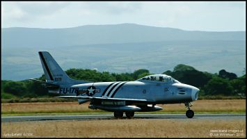 NA F86A Sabre on
runway 25 - July 2003
NA F86A Sabre on
runway 25 - July 2003
|
 Air race finish line
at Jurby - July 2003
Air race finish line
at Jurby - July 2003
|
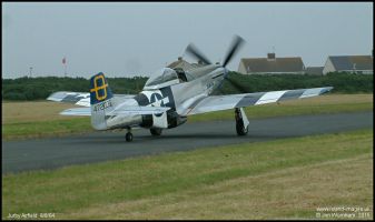
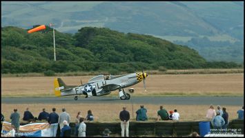 Mustang 'Janie' on
runway 25 - July 2003
Mustang 'Janie' on
runway 25 - July 2003
|
 RAF Nimrod MR2 flying
display - July 2003
RAF Nimrod MR2 flying
display - July 2003
|
 RAF Harrier display
- August 2004
RAF Harrier display
- August 2004
|
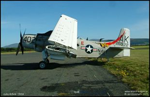 Douglas A1 Skyraider
parked on the short runway - August 2004
Douglas A1 Skyraider
parked on the short runway - August 2004
|
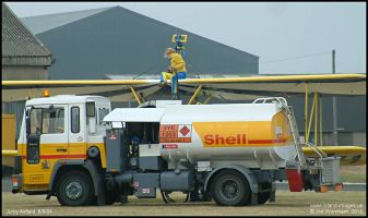 Refuelling a Boeing
Stearman - August 2004
Refuelling a Boeing
Stearman - August 2004
|
 Mustang 'Jumpin Jaques'
taxies for departure - August 2004
Mustang 'Jumpin Jaques'
taxies for departure - August 2004
|
Sadly the 2004
event was to be the last major aviation use of Jurby, with costs constantly
exceeded income and many spectators choosing to view the show from outside
the airfield rather than pay to come in. With the untimely death of the
main driving force behind the shows, Captain Winston Oliver of Manx Airlines,
it seems unlikely that there will be another. These days Jurby is
mainly a motor racing circuit, with only very occasional aviation activities,
usually associated with film making.
Changes to Area Control
In the early 2000s changes
by National Air Traffic Services (NATS) to area control sector boundaries
put Ronaldsway under the dividing line between Manchester Control and Scottish
Control. To the south east, Manchester's Isle of Man sector controlled
airway 'Bravo Three' to Wallesey and advisory route 'Whiskey Two Delta'
to Pole Hill. In the other direction, Scottish Control's Antrim Sector
controlled 'Bravo Three' to Belfast, advisory route 'Whiskey Nine One One
Delta' between BOYNE (halfway to Dublin) and Dean Cross in Cumbria and
advisory Whiskey Nine Two Eight Delta northwards from the 'IOM' beacon
to BLACA, on the Mull of Galloway. The airspace to the northwest of the
Isle of Man was changed considerably, with the 'Strangford Control Area'
enlarging the airspace available for inbound and outbound traffic from
the Belfast airports, at the same time all this airspace including airway
B3 being reclassified from Class A to Class D.
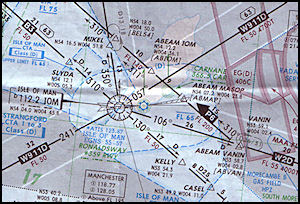
|
2003 Airways Chart
The boundary between
Scottish Control and Manchester Control was 5 miles south of the centreline
of Advisory Route W911D
|
|
Radar facilities used
by area control had been updated, the St Anne's S264 50cm radar had been
replaced by a Watchman/SSR system and was the main radar used by Manchester
Control over the Irish Sea. Scottish Control used the radar located at
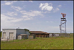
Lowther Hill in south west Scotland.
 St Anne's Watchman
Radar
St Anne's Watchman
Radar
|
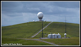 Lowther Hill Radar
Site
Lowther Hill Radar
Site
|
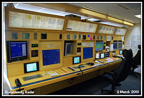
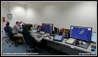
The Approach/Radar
Room Rebuilt in 2003
Following the successful
reconstruction of the Aerodrome Control desk, it was decided to refurbish
the radar room. The metal desk originally constructed in the early 1980s
was getting very much past its 'best before' date, modifications made over
the years leaving the structure in a much weakened state. To ensure that
the design was right a wooden 'mock up' was produced enabling controllers
to sit at the workstation and test proposed locations of equipment, making
suggestions as to how the design could be improved.
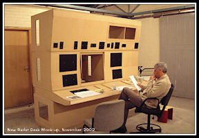
|
Mock-up of the Proposed
new Radar desk
|
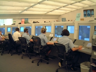
To enable the radar
room to be rebuilt, a temporary control room was constructed in the same
location as had been used for the temporary VCR on the second floor of
the tower. The control desk mock-up came in very useful as with equipment
installed it became the radar control desk. Space was limited and there
was only room for one controller and one assistant, the work being carried
out during March and April 2003.
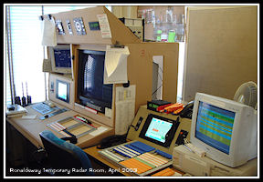 Ronaldsway (temporary)
Radar - April 2003
Ronaldsway (temporary)
Radar - April 2003
|
 The new Radar Desk
- April 2003
The new Radar Desk
- April 2003
|
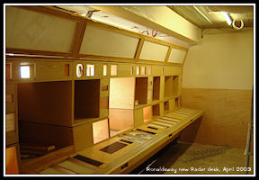
By May 2003 the new
desk was ready for use and Radar moved back upstairs. Initially only one
radar control position was available but by the end of the month nearly
all equipment had been installed. Provision was made for an ATC Assistant
on the right end of the desk, with an Approach Procedural control position
next and then Radar One and Radar Two positions. One slight disadvantage
of the new desk was that there had been no space left for the Radar Control
Panel, which was relocated to the Telecommunication Equipment room on the
floor below. Whilst not often requiring adjustments there were occasions
when selections of different functions needed to be made and with reductions
over the years to the ATC Engineering department staff complement there
wasn't always an engineer on duty to do this.
 The new Radar Desk
completed
The new Radar Desk
completed
|
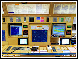
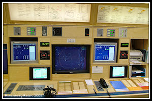 Radar, Controller
Workstation
Radar, Controller
Workstation
|
 Radar, Assistant
Workstation
Radar, Assistant
Workstation
|
Flight Testing
at Ronaldsway
From time to time Ronaldsway
has been visited by manufacturers aircraft on flight test programs, a major
one in the 2000s being the ill fated British Aerospace Nimrod MR4. Apparently
the Instrument Landing System signal on runway 26 is very 'pure', being
over water and hence ideal for flight test purposes.
 Nimrod MR4 ZJ518
at Ronaldsway - Feb 2005
Nimrod MR4 ZJ518
at Ronaldsway - Feb 2005
|
 Nimrod MR4 ZJ516
- Feb 2007
Nimrod MR4 ZJ516
- Feb 2007
|
Area Control Standing
Agreements and 'Silent' Handovers
Although Ronaldsway
arrivals and departures via 'airways' were initially individually co-ordinated
with the area control units, starting with Scottish a system of 'agreed
levels' and silent handovers from radar controller to radar controller
was instigated, further reducing the amount of telephone calls needed.
After an initial ETA was passed to Ronaldsway, Scottish would route inbound
aircraft to the 'IOM' beacon and descend them to Flight Level 70, communications
could be transferred earlier, but the 'Release Point' where Control was
transferred to Ronaldsway was 25 miles before the 'IOM'. For outbound flights,
Ronaldsway Tower would pass a 'departure warning' with a provisional airborne
time to Scottish and the aircraft would be climbed to Flight Level 60,
the only exception to these levels being aircraft routing via W911D to
Dean Cross, where the standard inbound level was FL80 and outbound FL 70.
By 2005 the main airway
across the Isle of Man, routing from the Wallesey VOR 'WAL' on the Wirral,
via the 'IOM' VOR to Belfast VOR 'BEL' had been re-designated
as 'Lima Ten' This was the fourth designator for this route, being established
in 1951 as 'Red Three', subsequently 'Blue Three', 'Bravo Three'
before 'Lima Ten'.
 2009 RAF 'Airways'
Chart
2009 RAF 'Airways'
Chart
|
The system of standing
agreements was later extended to Manchester Centre, inbound aircraft via
airway L10 being positioned on radar headings by Manchester Control onto
the northern side of the airway and descended to Flight Level 80, whilst
outbound aircraft being positioned by Ronaldsway Radar to the south side
of the airway climbing to Flight Level 70. Usually all handovers were 'silent'
between Area and Approach, but sometimes phone co-ordination was required
to expedite traffic. All Approach ATC operations were now geared around
the use of radar, the 'Approach' position in radar not being manned, standard
staffing being a radar controller and approach assistant, the second radar
position being opened up if traffic levels require it.
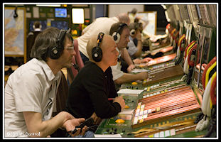 Scottish Area Control
Centre
Scottish Area Control
Centre
|
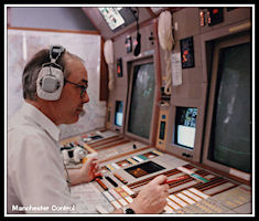 Manchester Area Control
Centre
Manchester Area Control
Centre
|
Ronaldsway Barco/FRL
Radar Display in various modes of operation
The FRL radar displays
could be configured to suit the user and just about everybody had their
own favourite set-up. The picture could be zoomed in or out, offset from
centre, operated in 'full screen' mode or with the control panel and a
'picture in picture' display. There was a selection of 'Map Scenes' selectable
from the menu, which were made up of various overlays that could be selected
or de-selected as required. Special overlays were provided for carrying
out Surveillance Radar Approaches (SRAs) marked with the advisory altitudes
or height to passed at each mile from touchdown.
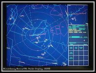 40nm with Control
Panel
40nm with Control
Panel
|
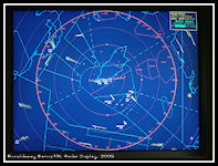 40nm Full Screen
|
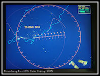 Runway 26 QNH SRA
|
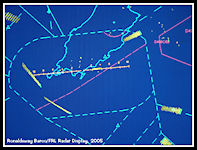 Primary Radar Only
|
More Airfield
Changes
By 2006 runway 17/35
had been closed, mainly on safety grounds as the new cargo terminal was
directly north of the runway, this had already resulted in a considerably
displaced landing threshold. The northern section became taxiway 'Foxtrot',
the southern section was closed but came back into use later for parking
aircraft. The 'link taxiway' that had run across the southern edge of the
apron was also closed to make more parking stands. While the extra stands
were very welcome, it did make more ATC planning required at busy times
and with less routes available onto the east and west aprons, arriving
aircraft sometimes had to be held further away waiting for departing aircraft
to taxi. Operations in poor visibility conditions were slower as more confliction
points now existed on the taxiways.
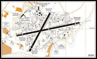 Airfield Diagram
2006
Airfield Diagram
2006
|
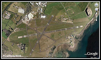 Google Earth Image
2006
Google Earth Image
2006
|
The Radar Displays
Replaced in 2008
By 2008 the original
Barco CRT displays used since the radar replacement program in 1995 were
becoming less reliable and needing repair on a regular basis. The display
cabinets were very bulky and heavy and took a considerable effort to move
via the stairs (no lift!) in the control tower and so were replaced by
more modern TFT 'flat screen' displays which were more closely integrated
into the desks. The picture displayed was the same as before.
|
|
|
 Flat screen TFT Radar
Display
Flat screen TFT Radar
Display
|
 Flat Screen TFT Display
close-up
Flat Screen TFT Display
close-up
|
Ronaldsway main
runway extended - the RESA Project
To comply with future
Runway End Safety Area (RESA) requirements, some changes needed to be made
to the runways at Ronaldsway. The 'easiest' option was to do nothing to
the physical length of the runways, but reduce the 'declared distances'
for landing and take off to produce the required RESAs at each end. This
would have been acceptable for the short haul turboprop and small jet aircraft
operating at the time but would be restrictive to larger jets and longer
routes, so a major construction project was initiated to physically extend
runway 26/08 at either end. The first part of the project undertaken was
at the westerly end where the required land already existed, taxiway 'Alpha'
also being extended to the new end of the runway. This stage was
completed and in operation in 2008.
|
Airfield Diagram
2008
Showing the extension
to the western end of runway 26/08 and taxiway 'Alpha' linking to the new
starter extension
|
|
The extension at the
eastern end was not going to be so easy. To the east of runway 26 the land
sloped down sharply to a rocky foreshore and a metal gantry carried the
runway 26 approach lights over the sea. The plan was to construct a rock
wall around the extension area and then infilled with dredged sand before
constructing the runway and taxiway extension.
|
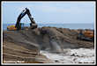
Ronaldsway RESA Project
The area to the east
of runway 26 showing the approach lighting gantry.
|
Work had started by
March 2009 and at the end of the month the initial part of the rock boundary
enclosing the infill area was in place. Work continued at a rapid rate
and by the end of the year the project was substantially complete.
One aspect of the RESA
project that maybe deserved more consideration was the provision of Approach
Lights for runway 26. With a Catagory One ILS (Instrument Landing
System), the minimum height a pilot can descend to without a 'visual reference',
i.e the runway or approach lights is around 200ft (it varies between aircraft
types and companies). Before the runway was extended the approach
lights extended out to sea on a gantry, with an overall length of 427 metres
with two crossbars. When the project was completed, the approach lights
only started at the physical and of the runway, reducing their length to
360 metres. In low cloud or foggy conditions, this could make the
difference between an aircraft being able to land or having to commence
a 'go around' if the pilot doesn't see the lights by 'descision height'.
A 'standard' approach light system for a CAT 1 ILS equipped runway is 900
metres long with 5 crossbars.
2009 New Air Traffic
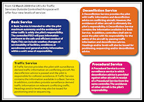
Services outside Controlled Airspace (ATSOCAS)
After a period of consultation
involving all interested parties, new rules for Air Traffic Services Outside
Controlled Airspace (ATSOCAS) were introduced in March 2009. Under the
previous arrangements, types of service provided were: Alerting Service,
Flight Information Service, Radar Information Service and Radar Advisory
Service. There were, however, different interpretations of these services
between civil and military units, leading to pilot confusion as to what
they were actually getting. Under the new system, pilots could expect exactly
the same service whether working a military or civil ATC unit. The new
services provided were: Basic Service, Traffic Service, Deconfliction Service
and Procedural Service. Controllers were requested to offer the services
only as specified under the new rules, to encourage pilots to request the
level of service appropriate to their flight conditions.
|
Air Traffic Services
Outside Controlled Airspace (ATSOCAS)
Section of a publicity
leaflet widely distributed to pilots and controllers before the new services
came into operation
|
|
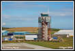
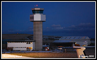
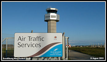
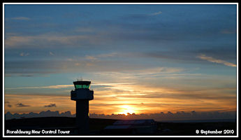
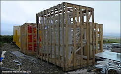
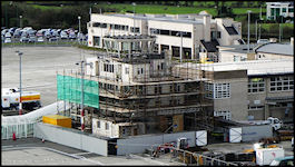
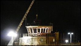
The New Control Tower Project
Another project to get
underway in 2009 was a replacement for the 1943 control tower. Although
having served well for a building that had probably been designed to last
less than 10 years during WW2, by the 1990s it was showing its age
with damp being a major internal problem. It's location was also
awkward, preventing any further expansion of the airport terminal departures
pier and sight lines needed addressing, as the threshold of runway 21 was
only observable by using a CCTV camera system. Several locations were examined
before the final site was settled, just north of the former runway 17/35
close to the east apron boundary. Work commenced in January 2009
and continued throughout the year, with the majority of external construction
being completed by the end of the year.
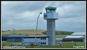
2010 - Last year in the old
Control Tower
An era was coming
to an end, with the new control due to be commissioned and the 1944 Royal
Navy tower that had served
civil ATC for over sixty
years scheduled for demolition shortly after it was vacated. The airport
runway and taxiway extensions had been completed.
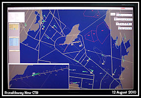
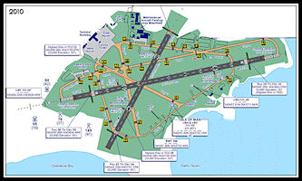 2010 Airfield Diagram
|
Preparing for the
big move
With the new tower structurally
completed, ATC started 2010 working in the old tower whilst all the technical
equipment was installed in the new. Very little was to be transferred from
old to new and a large training program would be required for both the
technical staff and air traffic controllers and assistants. This would
have to be done while still providing a full service from the old tower,
with no extra staff available to help out. At times resources were stretched
with staff having to move between the old and new towers.
A photo tour
of the old Control Tower in its last year of operation
 The old control tower
viewed from the new
The old control tower
viewed from the new
|
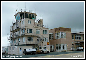 The old control tower
from ground level
The old control tower
from ground level
|
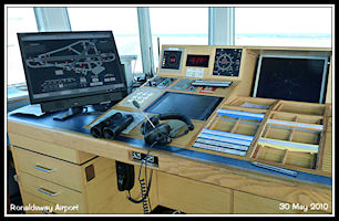
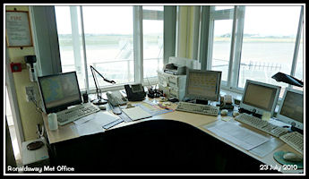
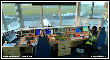
The Visual Control
Room 'Ronaldsway Tower' 118.9 Mhz
Top floor of the Tower,
added to the original in 1960
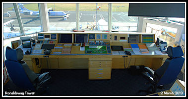 The Visual Control
Room Desk
The Visual Control
Room Desk
|
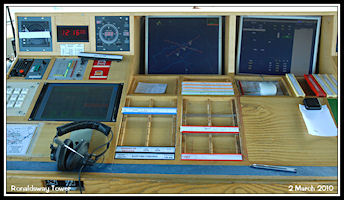 Controller Working
Position
Controller Working
Position
|
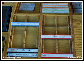 Flight Progress Strip
Bay
Flight Progress Strip
Bay
|
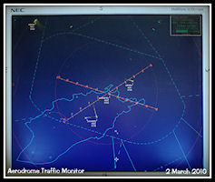 Aerodrome Traffic
Monitor
Aerodrome Traffic
Monitor
|
 New Airfield Lighting
Control Panel
New Airfield Lighting
Control Panel
|
 Aldis Signalling
Lamp
Aldis Signalling
Lamp
|
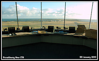
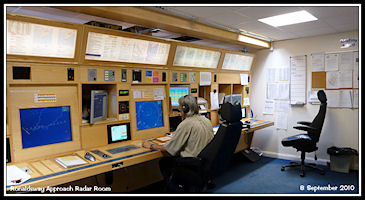
The Approach Radar
Control Room 'Ronaldsway Radar' 120.850 118.2
Floor below the Visual
Control Room, originally the Royal Navy 'Watch Office' at the top of the
tower.
 The Approach Radar
Control Desk
The Approach Radar
Control Desk
|
 Controller Working
Position
Controller Working
Position
|
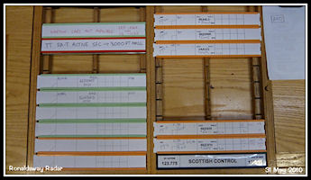 Radar Flight Progress
Strip Bay
Radar Flight Progress
Strip Bay
|
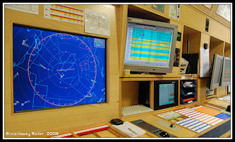
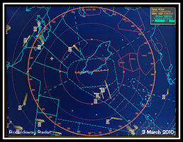 Watchman/SSR Radar
Display
Watchman/SSR Radar
Display
|
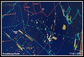 Watchman with Anaprop
Clutter
Watchman with Anaprop
Clutter
|
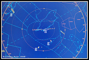
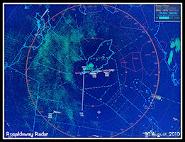 Watchman 'Raw' Radar
|
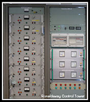
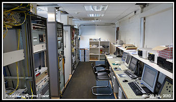
The Air Traffic Engineering
Department
Second floor of the
tower, the original Royal Navy and civil ATC Control room until the 1960s
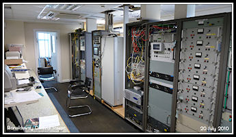 ATC Engineering Equipment
Room
ATC Engineering Equipment
Room
|
 VHF Radio Receivers
|
 ATC Engineering Equipment
Room
ATC Engineering Equipment
Room
|
The Meteorological
Office
Located on the first
floor of the control tower building, where it was most likely established
in 1944 by the Royal Navy.
Moved to a new home
in 2010 in Viscount House, away from ATC for the first time.
 Met Forecaster's
Desk
Met Forecaster's
Desk
|
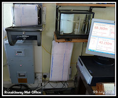 Equipment Old &
New
Equipment Old &
New
|
 Met Observer's Desk
|
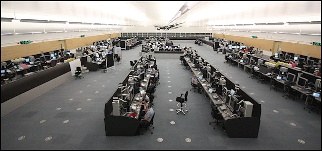
Area Control Services
The New
Prestwick Centre
At the end of January
2010 Manchester Centre was closed down and operations transferred to the
new Scottish Centre at Prestwick. The new ATCC had initially opened in
October 2009 when Shanwick Oceanic Control moved across from the adjacent
Atlantic House, followed by Scottish Military in October and Scottish Civil
in November. The move of Manchester ACC completed UK Area Control provider
NATS policy of just having two UK area control centres.
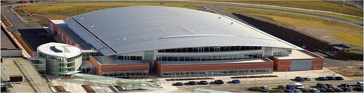 NATS new Prestwick
Air Traffic Control Centre
NATS new Prestwick
Air Traffic Control Centre
|
The move had very little
effect on operations at Ronaldsway as all procedures remained the same
as before. The only minor problem was trying to remember that the unit
callsign for flights to the south was now 'Scottish Control'. To the north
west was Antrim Sector using 123.775 and to the south east Isle of Man
Sector on 133.050 or 128.050 when 'bandboxed' with the Wallesey Sector
in quieter traffic periods. Although not affecting Ronaldsway at all, the
high level traffic over the island was controlled by another Scottish Sector,
Antrim, using 129.1 Mhz. A basic Flight Information Service was provided
to the north of the island by 'Scottish Information' on 119.875 Mhz.
 Prestwick Centre
- Operations Room
Prestwick Centre
- Operations Room
|
London Centre
Control of military
traffic operating over and around the Isle of Man was still by 'London
Military', located at the London Air Traffic Control Centre, Swanwick.
They were also the usual controlling authority for the Air to Air Refuelling
Area (AARA13) located over the Irish Sea to the east of the island. Another
important function provided from Swanwick was the Distress and Diversion
Cell which provides a service to military and civil aircraft in emergency
situations. To the north of the island, Scottish Military provided a similar
service.
 London Military 'LJAO'
|
Also being provided
from Swanwick was 'London Information' a Flight Information Service that
provides a 'Basic Service' to aircraft operating in the London Flight Information
Region, from the English Channel right up to the boundary with Scottish
airspace.
Preparing for operations from
the new Control Tower
With so much different
equipment going into the new tower, it was going to take quite a while
to firstly install it all and then for ATC engineers,
controllers and assistants
to train in its use while still providing a service from the old tower.
Although theoretical work could commence straight away,
it was not until all
of the equipment was installed and working that we could do the essential
practical 'hands on' training.
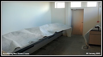
January 2010
Although the structure
of the new building was complete, a huge amount of work was still needed
before ATC could move in, starting with building the control desks and
installing the vast amount of wiring and equipment needed.
 The New Control Tower
|
 Visual Control Room
|
 Approach Radar Control
Room
Approach Radar Control
Room
|
March/April 2010
Equipment continued
to be installed and we could start to see how the operational areas were
going to work. Controllers and assistants paid regular visits to the new
building and provided feedback and suggestions as to how equipment could
be arranged and utilised. Unit training manager Paul Warriner was very
busy working out an ATC training program for the new tower.
 Visual Control Room
|
 Approach Radar Control
Room
Approach Radar Control
Room
|
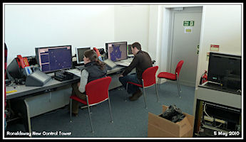
May/June 2010
A large amount of the
operational equipment was now working in the new tower and the training
program moved away from just looking at manuals and attending
classroom training sessions
to 'hands on' sessions with the equipment, quite difficult to schedule
in while still providing a full ATC service from the old tower. Just travelling
from the old building to the new for training and then back again took
at least 20 minutes.
 Approach Radar Room
|
 Visual Control Room
|
 VCR ATCO Working
Position
VCR ATCO Working
Position
|
Configuring the new
Park Air Surveillance Displays
For a while we had one
of the new surveillance displays installed in the old radar room for evaluation
and training, the radar mapping as initially supplied needed
quite a lot of work
before it came up to operational requirements.
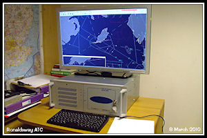 New Park Air Surveillance
Display
New Park Air Surveillance
Display
|
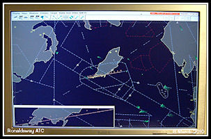 Display with initial
Mapping
Display with initial
Mapping
|
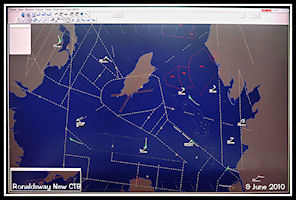 Display with revised
Mapping
Display with revised
Mapping
|
 Display with final
mapping revision
Display with final
mapping revision
|
August 2010
With an operational
date of early September decided, the last touches were being made to the
inside of the building
with a last training
push to make sure everybody was signed off before the move. A completely
revised manual of Air Traffic Services Part 2
had been produced by
supervisor Martin Benson for the new tower and issued to all controllers.
 Almost ready for
Operations!
Almost ready for
Operations!
|
 Checking Emergency
Evacuation Procedures
Checking Emergency
Evacuation Procedures
|
September 2010
Time to move home!
 7th September - 'O'
day tomorrow!
7th September - 'O'
day tomorrow!
|
 Dawn over the new
tower, 8th September
Dawn over the new
tower, 8th September
|
September 8th 2010
- The last day of operations in the old Tower
The move to the new
building was to be undertaken during the early afternoon with Senior Air
Traffic Engineer Lloyd Taggart having
prepared a detailed
timetable for the transfer of services. Despite all the planning and training,
there was always a possibility that something
unforeseen might happen
which would delay the move or force a return to the old building
 Old Control Tower
Visual Control Room
Old Control Tower
Visual Control Room
|
 Old Control Tower
Approach Radar Control Room
Old Control Tower
Approach Radar Control Room
|
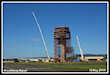
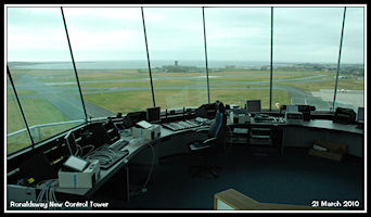
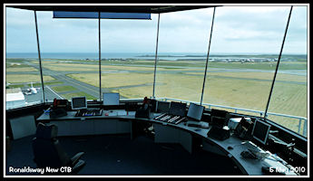
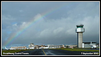
The new Control Tower
in operation - September 2010
The move from old to
new towers went (relatively) smoothly and the months of training paid off
with staff settling in to using the new equipment operationally
 New Control Tower
from Turkeyland
New Control Tower
from Turkeyland
|
 Visual Control Room
|
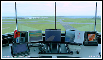
 Approach Radar Control
Room
Approach Radar Control
Room
|
Gone but not forgotten
- the VHF Direction Finder
One item of equipment
that didn't make it into the new control tower was the VHF D/F. With the
principle dating right back to the
start of Air Traffic
Control, the D/F was once considered to be an essential piece of ATC equipment
in the days of procedural control
and radar operations
without SSR. Over the last five years or so the D/F had suffered from unreliability,
spending more time out of service than in,
with some of the newer
controllers at Ronaldsway having hardly ever used it and it was decided
that the costs of refurbishing for the new
tower were not justified
and it was withdrawn permanently from use.
 Ronaldsway VHF D/F
Aerial and Equipment Cabin
Ronaldsway VHF D/F
Aerial and Equipment Cabin
|
 D/F Display and Frequency
Selector
D/F Display and Frequency
Selector
|
Carnane NDB 'CAR'
366.5 Khz
Another piece of equipment
unlikely to be returned to service was the Non Direction Beacon (NDB) at
Carnane. Having suffered a serious aerial fault that would be expensive
to repair, a safety study was being undertaken to assess the implications
of permanently withdrawing it from use. In recent years, the main use of
the beacon was when providing a procedural service if the radar was out
of use for any reason. By using both the 'IOM' and 'CAR' holding patterns,
inbound and outbound traffic could be expedited, but with the growing dependence
on ATC surveillance systems and a new radar system with more redundancy
capabilities in the pipeline, its return seemed unlikely.
 Carnane NDB Site
|
A New Introduction
- Radar based 'Safety Nets'
Included in the new
Park Air radar displays were three major advances over the previous ones
in the old control tower. These were computer processed 'Safety Nets' comprising
STCA - Short Term Conflict Alert, MSAW - Minimum Sector Altitude
Warning and AFDAS Approach Funnel Deviation Alerting System. They
require the Ronaldsway Secondary Surveillance Radar to be serviceable as
this is the source of data for the system processor.
STCA
The STCA is designed
to give controllers early warning of potential aircraft conflicts by processing
aircraft SSR returns and calculating likely future positions. If the system
considers that there is a possible conflict it will alert the controller
by highlighting the two (or more) aircraft returns. This works in two stages,
Stage 1 is intended to give 45 seconds warning and highlights labels in
steady yellow, Stage 2 gives 30 seconds warning and flashes labels in red.
The STCA can be triggered by high climb and descent rates of aircraft,
in this case a controller would confirm the cleared level with the pilot
or pilots and probably pass traffic information on the other aircraft involved.
 STCA Stage 2 Warning
|
MSAW
The MSAW is designed
to alert a controller if an aircraft is descending to a potentially dangerous
altitude. It requires a digital terrain model to be set up in the computer
processing and needs to be configured so as not to give spurious warning
on aircraft legitimately operating at lower altitudes, for example aircraft
operating under the Visual Flight Rules who must be in sight of the ground.
At the time of writing this system is still under evaluation at Ronaldsway
and not in operational use.
AFDAS
The AFDAS is deigned
to give controller warning if an aircraft is deviating from the final approach
track either laterally or vertically within about the last 8 miles of approach.
This system is more of use to larger airports with multiple parallel runways
used for simultaneous approaches and is probably unlikely to be used at
Ronaldsway as it can generate spurious warning for several reasons, the
most likely is due to an aircraft making a visual approach to the runway.
November 2010 - SnoClo!
Towards the end of November,
the island was hit by heavy snowfalls which completely covered the airfield,
making operations impossible until
the main runway, one
taxiway and the aprons could be cleared. From the new tower we had a great
view though!
 First light - 29th
November 2010
First light - 29th
November 2010
|
 View from the VCR
- Where are the Runways!
View from the VCR
- Where are the Runways!
|
 The new Control Tower
in the snow
The new Control Tower
in the snow
|
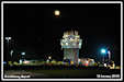
December 2010 - Snow
Again
The snow returned in
mid December, again disrupting operations but providing me with a nice
picture of the old Control Tower!
2010 had been a very
busy and often difficult year for all of the tower staff from Management
to Controllers and Assistants, but particularly for the
very small band of Air
Traffic Engineers led by Lloyd Taggart who had ensured that the move was
successfully completed. Thanks guys!
 The old Control Tower
|
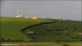
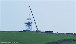
2011 - New radar
installation commences
The summer of 2011 saw
the first physical signs of the replacement radar for the Watchman/Cossor
system installed in 1995/98 which would have needed extensive work to continue
in operation. The selected system was a Selex ATCR-33S Primary Surveillance
Radar (PSR) combined with a Wide Area Multilateration (WAM) Mode-S Secondary
Surveillance Radar (SSR) System. The PSR was located on a new site just
outside the airfield boundary on Turkeyland hill, with the WAM system comprising
multiple sensors at sites around the island to improve low level surveillance
coverage to the north, where terrain shielding at present precluded cover
below 8000ft in places. The system will also allow surveillance of aircraft
and transponder equipped vehicles operating on the airfield.
 New PSR aerial in
packing cases
June 2011
New PSR aerial in
packing cases
June 2011
|
 Supporting tower
for Selex PSR
July 2011
Supporting tower
for Selex PSR
July 2011
|
 New PSR radar aerial
installed
July 2011
New PSR radar aerial
installed
July 2011
|
 Selex PSR aerial
with a WAM sensor
Selex PSR aerial
with a WAM sensor
|
 Selex WAM sensor
aerial
Selex WAM sensor
aerial
|
2011 - 2012 Demolition
of the old Control Tower
Delayed for various
reasons, demolition of the control tower built in 1943 during World War
2 for the Royal Navy commenced in October 2011
a year after the building
had been vacated by ATC
 27th October 2011
|
 27th October 2011
|
 28th October 2011
|
After some further delays,
final demolition took place towards the end of January 2012, removing all
traces
of the building that
had served military and civil Air Traffic Control at Ronaldsway for over
65 years.
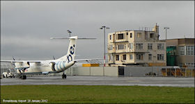 26th January 2012
|
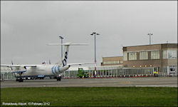 15th February 2012
|
2012 - Data arriving
from the new Surveillance system
Displays in the ATC
engineering equipment room
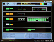 System Status Monitor
|
 Engineering Traffic
Display
Engineering Traffic
Display
|
 Multilateration Display
|
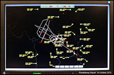
Mode-S and PSR data
as displayed in the Approach Radar room for evaluation purposes
June 2012 - Flight
under Visual Flight Rules (VFR) permitted in UK Airspace at Night
Until this date, VFR
flights had only been permitted during the hours of daylight. As
part of the integration of UK legislation with the Standardised European
Rules of the Air (SERA) which were to be implemented in December 2014,
VFR flights were now to be permitted at night. There had previousy
been a dispensation to operating under the Instrument Flight Rules (IFR)
at night, 'Special VFR', but that only applied withing Controlled Airspace.
Outside CAS, all flights had to be operated under the IFR. The main
effect for ATC was to remove the requiement to provide separation between
all flights at night whether operataing visually or not. The onus
was transferred back to pilots to maintain a safe distance from other aircraft
at night, if operating under the VFR.
ATC
at Ronaldsway in the 2010s
|