Island Images - The Isle of Man in Pictures
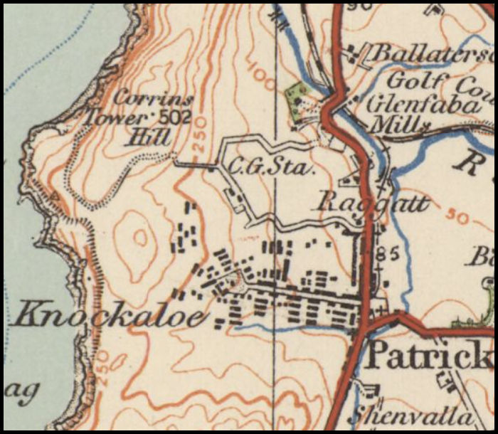
This is an extract from the 1920 Ordnance Survey 'One Inch' map showing the area covered by the Knockaloe internment camp and also the branch railway line serving it. Map courtesy of the National Library of Scotland.
An
Island Images
webpage ©
Jon Wornham